
4.9/5
( 099+ reviews)
Features TopoMapViewer
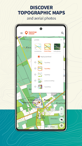
The TopoMapViewer is an application that allows you to view the standard topographic maps and aerial photographs of the National Geographic Institute of Belgium.
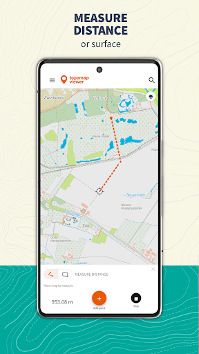
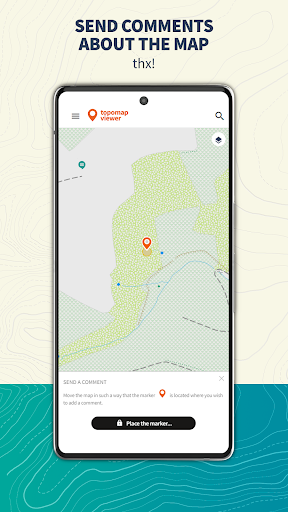
Measure distances, print a pdf version, send comments about mistakes on the map.
Import and share gpx trails and discover our beautiful country.
👥
Social Features
Connect and share with friends and the community.
📸
Camera Features
Advanced camera features with editing capabilities.
Screenshots
See the TopoMapViewer in Action
Get the App Today
Download on Google Play
Available for Android 8.0 and above